PurposeThe primary purpose of this excursion was to observe and research glacial landforms in the field. Sites were selected primarily from topographic maps and available literature from reputable sources (i.e. USGS and Pennsylvania Department of Natural Resources and Conservation/PADNRC) describing known glacial landforms of northwestern Pennsylvania. With a more specific emphasis, this field work was completed to observe the Chautauqua Drumlin field, where prominent landscape changes associated with glaciation are abundant and readily visible in the field. A secondary objective was to identify other landforms that have formed as a result of glacial processes, such as nearby Presque Isle State Park along the southern shoreline of Lake Erie. Because of the relatively large scale of these features and limited field time, measurements and calculations (i.e. elevations, bearings, and statistics) were primarily completed using data provided from USGS databases and other reputable sources.
|
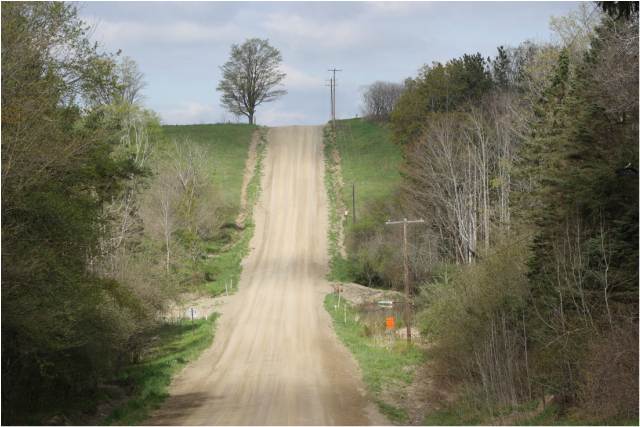
East-looking photo along Kimball Road. Image shows short axis of mapped drumlin. Elevation is approximately 65 feet above valley floor. Lee slope runs horizontally across image. Photo: C Miller.
|
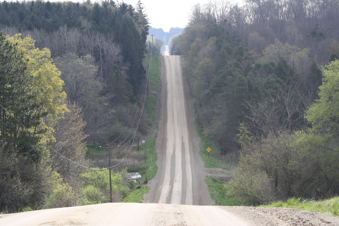
East-looking photo of drumlin series along Kimball Road. Note high variability of topography in background. Valley floors in between slopes contain small, lush, and dense wetlands. Photo: C Miller 2016.
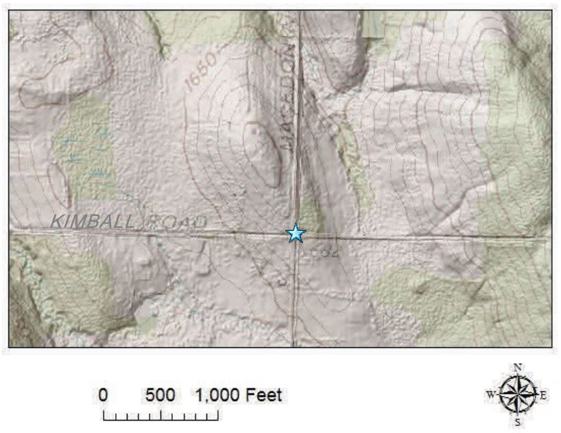
Topographic map showing drumlin series along Kimball Road. Image acquired from PADNRC. Web. Accessed from http://www.gis.dcnr.state.pa.us/topo/ogf/OGF_Drumlins.pdf
|
Outcomes
Outcomes of this fieldwork are aimed to allow for proper identification of known glacial landforms in the field, and to document observations and measurements that are associated with the surrounding landscape. Observations were made and recorded at numerous sites to describe, in detail, surficial features such as topographic variation, regional trends, and to perform an overall general terrain analysis. Additionally, surveying, mapping, and data interpretation techniques were applied in an effort to describe the geomorphology of the region. This was primarily completed digitally; however, approximate measurements were made in the field to describe the landscape in a general sense for qualitative purposes.
Lastly, the ultimate goal of the study of geomorphology is to gain insight into the structure, process, and time associated with the genesis of landforms. In this special case, however, drumlin genesis is a highly debated and controversial topic among geoscientists. Moreover, the genesis of drumlins may (and likely does) vary drastically in differing regions. This may be a result of local geology (resistive/non-resistive bedrock), timing of events (age of landform), and regional processes (such as climate) that may affect landscapes differently in respective locales.
|
Webpage presentation for ES 546 Field Geomorphology, Emporia State University 2016. By Corey Miller, Graduate Student.
