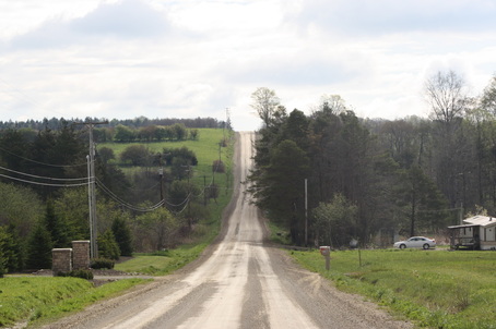
East-looking image on Kimball Road. Image shows short axis of known drumlin. Photo by C Miller.
|
Future Work & ConclusionDetermining the internal composition and structure of numerous drumlins within close proximity may give insight into the genesis of drumlins within the region. There is a clear connection between internal structure and associated genesis. For example, Accretion Theory would suggest that a zone of higher resistance is present (likely in the form of local bedrock – perhaps a bedrock pinnacle?), and because of this measurable/observable differences could be attained in the field through the use of drilling (intrusive) or numerous surface and downhole geophysical methods (unobtrusive and assumes access to bedrock wells). Likewise, folding structures as described in Boulton’s Theory may be modeled by gathering subsurface data using the methods described above. Combining both small scale geophysical data with large scale regional geomorphology, geology, and geography may provide further insight into drumlin genesis within the region, and may further provide further insight into glacial dynamics in northwestern Pennsylvania.
|
References
Aber, J. S. (2015). Glacial Geomorphology Deposition. Web. Accessed 11, 2016, from http://academic.emporia.edu/aberjame/ice/lec04/lec4.htm#drum
Delano, H. (1991). Presque Isle State Park Erie County. Web. Accessed May 11, 2016, from http://www.dcnr.state.pa.us/cs/groups/public/documents/document/dcnr_015911.pdf
Pennsylvania Department of Natural Resources and Conservation (PADNRC), n.d. East Lake Section: Central and Lowland Provice. Web. Accessed May 11, 2016, from http://www.dcnr.state.pa.us/topogeo/field/map13/13els/index.htm
Reese, S. (2013). Drumlins: Erie County. Web. Accessed May 11, 2016, from http://www.gis.dcnr.state.pa.us/topo/ogf/OGF_Drumlins.pdf
Saha, K. (2010). Object Oriented Classification of Drumlins from Digital Elevation Models. Web. Accessed May 11, 2016, from https://etd.ohiolink.edu/rws_etd/document/get/kent1289558937/inline
Webpage presentation for ES 767 Wetland Environments, Emporia State University 2016. By Corey Miller, Graduate Student.
